FAA Airport Information
Location
FAA Identifier: BTM
Lat/Long: 45-57-17.3000N 112-29-50.9000W
45-57.288333N 112-29.848333W
45.9548056,-112.4974722
(estimated)
Elevation: 5550.5 ft. / 1691.8 m (surveyed)
Variation: 12E (2020)
From city: 3 miles SE of BUTTE, MT
Time zone: UTC -6 (UTC -7 during Standard Time)
Zip code: 59701
Airport Communications
CTAF/UNICOM: 123.0
WX ASOS: 135.175 (406-494-1870)
WX AWOS-AV at 3U3 (19 nm NW): 122.8 (406-563-8275)
-
APCH/DEP SVC PRVDD BY SALT LAKE ARTCC ON FREQS 132.4/338.3 (BUTTE RCAG).
-
COPPERTOWN RCO 122.65 (GREAT FALLS RADIO)
Nearby radio navigation aids
VOR radial/distance VOR name Freq Var
CPNr098/11.4COPPERTOWN VOR/DME111.6016E
HIAr274/14.8WHITEHALL VOR/DME113.7018E
Airport Operations
Airport use: Open to the public
Activation date: 04/1940
Control tower: no
ARTCC: SALT LAKE CITY CENTER
FSS: GREAT FALLS FLIGHT SERVICE STATION
NOTAMs facility: BTM (NOTAM-D service available)
Wind indicator: lighted
Segmented circle: yes
Lights: ACTVT MALSR RWY 15; REIL RWY 12 & 30; PAPI RWY 12 & 30; VASI RWY 33; MIRL RWY 15/33 & 12/30 - CTAF. PAPI RWY 15 OPR CONSLY.
Beacon: white-green (lighted land airport)
Landing fee
Fire and rescue: ARFF index A
Airline operations: PPR FOR UNSKED ACR OPNS WITH MORE THAN 30 PSGR SEATS CALL AMGR 406-494-3771.
International operations: customs landing rights airport
Runways
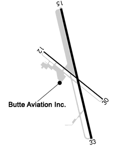
Runway 15/33
Runway Information
Runway 15/33
Dimensions: 9000 x 150 ft. / 2743 x 46 m
Surface: asphalt/grooved, in good condition
Weight bearing capacity:
PCN 45 /F/A/X/T
Single wheel: 60.0
Double wheel: 125.0
Double tandem: 175.0
Runway edge lights: medium intensity
RUNWAY 15 RUNWAY 33
Latitude: 45-58.015583N45-56.573850N
Longitude: 112-30.072095W112-29.589963W
Elevation: 5506.7 ft.5550.4 ft.
Traffic pattern: rightleft
Runway heading: 155 magnetic, 167 true335 magnetic, 347 true
Declared distances: TORA:9001 TODA:9001 ASDA:9001 LDA:9001TORA:9001 TODA:9001 ASDA:9001 LDA:9001
Markings: precision, in good conditionbasic, in good condition
Visual slope indicator: 4-light PAPI on left (3.50 degrees glide path)2-box VASI on left (3.00 degrees glide path)
DO NOT USE VASI BYD 1.5 MI DUE TO HIGH TERRAIN.
Approach lights: MALSR: 1,400 foot medium intensity approach lighting system with runway alignment indicator lights
Runway end identifier lights: nono
Touchdown point: yes, no lightsyes, no lights
Instrument approach: ILS/DME
Obstructions: none65 ft. tower, 2986 ft. from runway, 248 ft. right of centerline, 42:1 slope to clear
Runway 12/30
Runway 12/30
Dimensions: 5100 x 75 ft. / 1554 x 23 m
Surface: asphalt/grooved, in good condition
SURFACE CONDITIONS UNMONITORED BETWEEN MIDNIGHT AND 5 A.M.
Weight bearing capacity:
PCN 3 /F/A/X/U
Single wheel: 12.5
Runway edge lights: medium intensity
Operational restrictions: RWY 12/30 RSTRD TO ACFT 12,500 LBS PER SWL (SINGLE WHEEL LOAD)
RUNWAY 12 RUNWAY 30
Latitude: 45-57.539507N45-57.010190N
Longitude: 112-30.344165W112-29.411215W
Elevation: 5520.7 ft.5530.6 ft.
Traffic pattern: leftleft
Runway heading: 117 magnetic, 129 true297 magnetic, 309 true
Declared distances: TORA:5100 TODA:5100 ASDA:5100 LDA:5100TORA:5100 TODA:5100 ASDA:5100 LDA:5100
Markings: basic, in good conditionbasic, in good condition
Visual slope indicator: 2-light PAPI on left (4.00 degrees glide path)
PAPI STAIGHT-IN ONLY.2-light PAPI on left (4.00 degrees glide path)
PAPI RSTRD TO 2.1 NM FM RY 30 THLD DUE TO HIGH TERRAIN.
Runway end identifier lights: yesyes
Touchdown point: yes, no lightsyes, no lights
Obstructions: 16 ft. road, 560 ft. from runway, 275 ft. right of centerline, 22:1 slope to clear36 ft. bldg, 1251 ft. from runway, 100 ft. right of centerline, 29:1 slope to clear